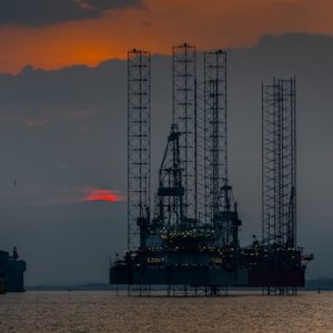
Geophysical Exploration and its Impact on Discovery


STORY INLINE POST


 By Gerardo Clemente | Coordinator of retirees -
Wed, 09/07/2022 - 09:00
By Gerardo Clemente | Coordinator of retirees -
Wed, 09/07/2022 - 09:00
Why do we explore?
There is a natural curiosity in human beings, which moves us in search of who we are, why we are here, how the Earth, the oceans and the universe are made. The need to understand how things work moves us to explore, observe and reconstruct the past of things. During the history of mankind, we have learned to use natural resources to facilitate survival and make life more comfortable, starting with the most elemental resources like rocks, then fire, metals, steam, electricity, oil and gas, etc. To obtain these natural resources, communities established methods, processes and procedures to locate where these resources are and why they are there, and then how to exploit and transform them. This is called exploration for subsurface natural resources and, in particular for mining, geothermal energy, oil and gas, groundwater, and many other things.
With current technology we are able to acquire, process and interpret the physical response of various rock properties that can help us infer the behavior of the Earth’s surface and its subsoil, depending on the type of rock and fluids there, according to the geological history of the basin. This is called Exploration Geophysics. In the oil and gas industry, this has become an essential discipline that can help us along with other geology specialties, such as tectonics, structural, sedimentology, petrophysics, geochemistry, etc., to build and reconstruct Earth models, to accurately locate the content of the natural resources we are looking for, including hydrocarbons for the oil and gas industry.
What makes geophysics so essential?
Before the development of geophysics, building a geological model was based on the observation of outcrops, the landscape, and the effect of the seasons on it and the relative variation of sea level and all available information was used to do it, but the main tool was the imagination, trying to explain what and why they were seeing happened. The uniformitarianism (James Hutton 1785) and continental drift (Alfred Wegener, 1912) theories are examples of this approach.
Once the geoscientist counts with the evidence of geophysical information, the knowledge of the earth evolves dramatically. An example of this approach is the plate tectonics theory, based on the paleomagnetism information analysis among other information.
All available information was used to build a model and explain why it happens based only on imagination and uniformitarianism theory (James Hutton 1785), continental drift (Alfred Wegener, 1912) are based on that kind of approach, then plate tectonics supported by evidence geophysics of paleomagnetism among other information, makes great changes in understanding the evolution of the Earth.
When geophysical methods begin to be used to correlate what we observe on the surface to the subsurface, we begin to reduce uncertainty over larger and larger areas around where we can observe and measure on the surface. Once we started drilling oil wells, we were able to measure the physical properties in the wells and differentiate the type of rock and the type of fluid in it, with electrical logs, spontaneous potential, etc., all the way down to sonic logs like developed reflection seismic methods, which allow us to build highly accurate geological models in increasingly complex areas. However, the challenge of finding hydrocarbons has become increasingly complex. I have witnessed in 35 years the evolution of the seismic acquisition method, from 48 channels to thousands of active channels per shot. This allows us to better sample the wave fields that bring information from the subsurface. Throughout these more than 30 years we have had to work together with specialists from other disciplines to better understand the theory behind each basin and the interrelationship between them. The more information from drilled wells and acquired geophysical data we have, the better the understanding of a particular area, based, of course, on the capacity and experience of the specialists on the multidisciplinary team.
So, geophysics has become a very important discipline that allows us to explore large areas, with a relatively low cost compared to drilling a well, but drilling a well in a strategic area is crucial to calibrate geophysical data. Of the five geophysical methods par excellence, remote sensing, potential methods (gravimetry and magnetic), the seismic reflection method and the controlled source electromagnetic method (CSEM) are used in the exploration process, starting with the analysis of the basin to see if there is evidence of an oil system working in the area, such as remote sensing to obtain evidence of hydrocarbon seepage on the surface. We can use gravimetry and magnetometry to identify the width of the sedimentary column, correlating the information with outcrops or any other available information and regional seismic data. The lines can help to build a regional model. For the play analysis, we use semi-regional 2D seismic data, in addition to those listed above, in the basin analysis. And in the generation of prospects, we use the 3D and CSEM seismic method and gravimetric and magnetic.
Geophysics has become an essential discipline for oil and gas exploration and from my point of view, it is very important that every company in the oil industry has a very experienced geophysics team, with professionals in data acquisition, experienced in seismic data processing and interpretation, along with specialists in seismic data processing and experts in seismic data interpretation and attributes.
You May Like


Most popular


