Regulate Drones Reasonably
STORY INLINE POST


Look up on any given day and flying across the sky might be an unmanned aircraft, flitting here and there. Drones are an increasingly ubiquitous technology for both business and pleasure. While their utility is recognized and attracting investment, companies and enthusiasts alike are discovering there is fine line between commercial and personal use and potential for UAVs to compromise security and privacy.
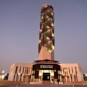
Airports are a singular point of focus due to the potential damage a drone could cause if it were to fly into an airplane’s turbine. To avoid cases of drones falling from the sky, flying into dangerous zones or crashing into infrastructure, players on all sides advocate the introduction of legislation.
“If the government approaches the regulation of drones the wrong way, they could either block the growth of the industry or encourage it to go wild,” says Sebastián Zepeda, President of Delair-Tech Mexico. “At the moment, there is little regulation not only in Mexico but all over the world.” Finding the middle ground between strict legislation and flexibility is crucial. A total ban could push people to fly drones illegally and lenient regulations could put security in jeopardy.
Internationally, the US fell behind in drone development because it pushed too hard early on and blocked the technology as it struggled to formulate appropriate legislation. Zepeda says Europe and Asia were left to grab the reins of leadership. Those regions are crafting new rules, which some companies are already using as a guideline.
Amazon, for one, is launching Prime Air, a delivery system that uses small drones to get packages to customers in under 30 minutes. The company declares on its website that it supports, “the pragmatic, flexible, risk-based approach to drone regulation that has been pursued by European authorities, in particular the European Aviation Safety Agency (EASA).” Similarly, Zepeda recommends the Mexican government look at international best practices to figure out the most efficient way to regulate the market and learn from the mistakes of other countries. “Proper regulation will foster the growth of the market and ensure the safe integration of drones into Mexican air- space,” says Zepeda.
THE RIGHT DRONE
There are two main types of drones in the industry, fixed- wing and rotary-wing. “Rotary-wing drones are a small and popular type that take off and land vertically,” Zepeda says. “They can manage stationary flight that allows them to hover extremely close to objects.” On the other hand, fixed-wing drones are similar to airplanes because they
take-off and land horizontally. They fly faster and for longer distances. While neither is more useful than the other, their application differs greatly, Zepeda says. “A company that wants to closely oversee a certain structure at a short distance should opt for a rotary wing drone while a long distance mission such as a topographical survey would benefit the most from a fixed-wing drone.”
Delair-Tech particularly specializes in fixed-wing drones. “From a technical point of view, missions that require fixed- wing drones are the most difficult,” Zepeda says. “They require BVLOS capabilities [flying beyond the pilot’s line of sight], robust avionics, long-range communications systems and resistance to harsh weather conditions. Being able to perform this type of mission is precisely our expertise.”
Drones are valuable management tools for the planning, execution and follow-up of such projects because they can rapidly provide quantitative, cost-efficient and reliable information. “It can give decision-makers both perspective of the current project status overall, regardless of its geographical spread, as well as detailed data on the blocking points to which they need to zoom in,” says Zepeda. Drones allow these projects to retrieve a clear image of terrain and structures.
The most versatile sensing technology the company uses is photogrammetry, in which it mounts a high- definition camera on the drone to capture geo-referenced, overlapping pictures of the area of interest. Images and information captured by drones can be used to create photographic 2-D scaled maps or 3-D models that are scaled and geo-referenced. “We are the technological leaders of the civil drone industry,” says Zepeda. “We can safely navigate the longest distances, fly in the most challenging environments and have the most sophisticated and precise remote sensing devises.”
Delair-Tech developed the first drone to be certified by a national civil aviation authority to operate beyond the pilot’s line of sight. “We also have the first and only fixed- wing civil drone that is capable of carrying high-frequency LiDAR sensors.” The company focuses on big mining companies, railroad operators, oil and gas operators, the Ministry of Communication and Transportation (SCT), PEMEX, the Federal Electricity Commission (CFE) and the National Water Commission (CONAGUA).
Appropriate regulations and user guidelines are needed to draw limits and avoid potential setbacks as the technology becomes commonplace.
305
You May Like


Most popular